News release from FDOT, Dec. 19th 2024
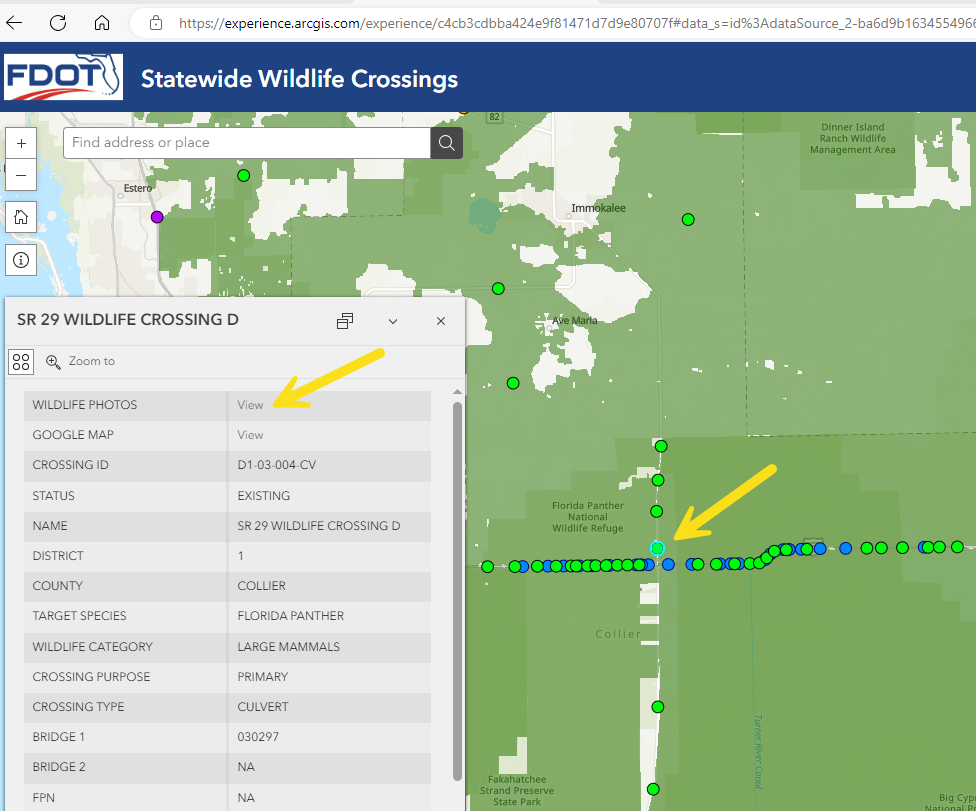
The FDOT Office of Environmental Management is excited to announce the release of our new, interactive Statewide Wildlife Crossing Map including photo galleries at crossings where cameras have been deployed.
For those of you familiar with the District 1 Google map and photos, this is a similar concept. We thank Brent Setchell for leading the way with his map and sharing his expertise to develop the statewide map. We also acknowledge the various partners such as USFWS, FGCU Wings of Hope Panther Posse, fStop Foundation, and Dr. Dan Smith for their photo and video contributions over the years. We welcome the continued sharing of pictures and videos to enhance the content of the new site from all of our partners.
Click HERE to open the map
As a quick tutorial, once you open the map, zoom in on a wildlife crossing of interest and click the dot. A box of attributes for that crossing will appear. If that crossing has a photo gallery, “View” will appear next to “Wildlife Photos”. Click the “View” link which will take you to the Google photo gallery (you might have to click past a warning (if allowed) if you are on a government computer).
We hope you enjoy exploring the map and photos. Please feel free to share with your colleagues, family, and friends.

